| À propos / About | Travaux / Work | Trappes | Self-series | Contact |
THIERRY PAYET
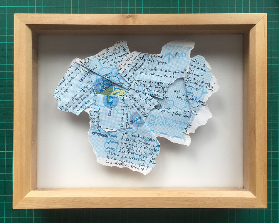
Narrations tectoniques - cartographie des mondes vécus
/ Tectonic narrations - Cartography of the lived worlds
Narrations tectoniques / Cartographie des mondes vécus est un ensemble de pièces qui :
Le projet s'est construit pendant un an :
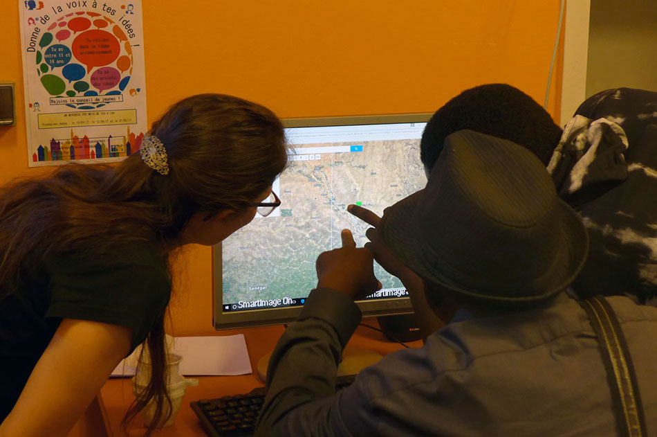
avec des groupes de personnes apprenant le français dans des Ateliers Sociaux Linguistiques (ASL).
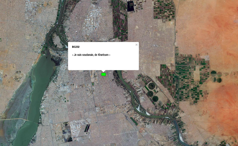
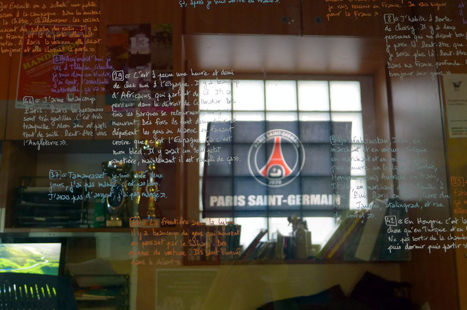
Les participants sont questionnés sur les lieux importants pour eux à leur arrivée en France, là d’où ils viennent, et sur la trajectoire. Chacun répond avec son niveau de français.
Les narrations récoltées construisent :
Cartographie Bédier-Chevaleret - avec repères (Gmaps)
Cartographie Bédier-Chevaleret - sans repère (OSM)
Cartographie Trappes - avec repères (Gmaps)
Cartographie Trappes - sans repère (OSM)
----------------------------------------------------------------------------------------------------------------------
Tectonic narrations/ Cartography of the lived worlds is a collection of artworks that :
- connect the local and global scales of territories (a neighbourhood, a city / the world) from places and lived spaces of its immigrant-inhabitantss
- raise aquestion : if people count as much as buildings then where is the real borderline of the city ?
- pave the ground for a definition of a world-city that's different from the classical metropolis.>
The project was built in one year :
- in Trappes (Paris suburb)
- in Bédier-Cheveleret (Paris, 13rd arrondissement)
All volonteered participants are individually asked questions about their important places when they arrived in France, where they're coming from, and on the path inbetween. Everyone is answering with his own level of French.
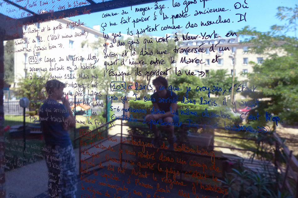
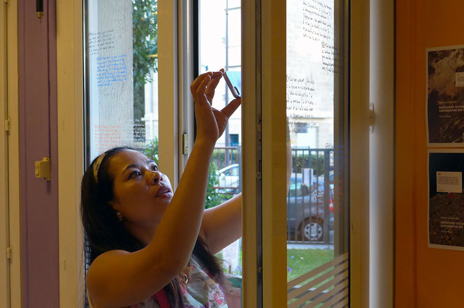
The collected narrations are discussed and shared to build the series of art work:
- Three exhibitions taht share their experience and places with the other publics of the social centers. expositions qui partagent les vécus et les territoires des participants avec les différents publics des centres sociaux (Bédier-Chevaleret)
- Digital cartographies built with the participants and the volonteering french teachers. For each group a GoogleMaps-type map with the usual landmarks. And another made made in OpenStreetMap (open source cartography) where all geographical landmarks have been erased, leaving the ground. The collected narrations are the only clues to where you are.
Cartographie Bédier-Chevaleret - with landmaks (Gmaps)
Cartographie Bédier-Chevaleret - no landmark (OSM)
Cartographie Trappes - with landmarks (Gmaps)
Cartographie Trappes - no landmark (OSM)